The upgrading of the Lunghezza–Guidonia section of the Rome–Pescara mainline, promoted by FS Group, achieved an important milestone with the new Guidonia Montecelio station. This construction project has also significantly advanced knowledge and understanding of regional history through major archaeological discoveries unearthed during construction.
Beginning in 2011, archaeology baseline surveys conducted by FS Engineering on behalf of RFI—in strict accordance with guidelines from the competent Heritage Authority—identified and recorded extensive archaeological evidence. These findings reveal continuous occupation of the area between the Republican (4th century BCE) and Imperial eras (2nd century CE). The entire process succeeded by balancing the delivery of vital public infrastructure with the preservation of the extraordinary historical and archaeological heritage brought to light by the excavations. This integrated approach continued throughout the procurement phase, culminating in the station’s opening in July 2026, and its success was driven by close collaboration between all the stakeholders, including the Ministry of Culture (MiC), with the local Heritage Authorities, FS Group (with its subsidiaries RFI and FS Engineering), the principal contractors with their appointed archaeological specialists, and the individual field researchers.
Remains of ancient human occupation emerged across the Guidonia Montecelio site, bounded by Provincial Road 27b to the north and Via della Longarina to the south (Fig. 1), and the discoveries include ancient roads, production sites, farming structures, such as drainage channels, travertine quarries, and necropolises with burials, providing critical new insights into ancient living conditions and customs.
Surprisingly, the excavations also opened a window into prehistory, dating back approximately 20,000 years to a remote period when a section of the travertine bedrock preserved the footprints of animals from the late Late Pleistocene era (Fig. 2).
This rare discovery in Italy highly deserved preservation and display within the new station, a move strongly requested by the Heritage Authorities and promptly supported by the FS Group. Consequently, a 1:1 scale cast of the footprint-bearing travertine section was created and installed on one of the station platforms, accompanied by scientific information panels for passengers to read while waiting for their trains.
The panels explain the geological process that formed the Testina-type travertine, a sedimentary rock composed mainly of calcium carbonate (CaCO₃). This process originates when groundwater rich in carbon dioxide (CO₂) and calcium rises toward the surface, typically through fractures or faults in the ground. In the area between Tivoli and Guidonia, this phenomenon has been active for a relatively recent period in geological terms—since the Late Pleistocene, 115,000 years ago—and is linked to both faultlines and volcanic activity in the nearby Alban Hills. The environment in which travertine forms is frequently characterised by mineralised water and gases emerging from the subsurface.
In the past, these geological phenomena captured the imagination of the local population. The area known today as Colle Fiorito was originally called the "Valley of the Witch" due to the noises and gas emissions, resembling shrill screams, produced by sulphurous vapours rising naturally to the surface. One of the most typical varieties of travertine stone is called "Testina", which forms in areas of almost stagnant water, such as pools. There, calcium carbonate slowly accumulates around small plants to create rounded, irregular shapes, recognisable by their nodular appearance and the small voids left by the decomposition of organic plant matter trapped during growth.
From geology to palaeontology. Fossil footprints.
This peculiar geological environment, composed of water pools and slowly solidifying carbonate muds, acted as an extraordinary "time machine", capturing and preserving traces of prehistoric life.
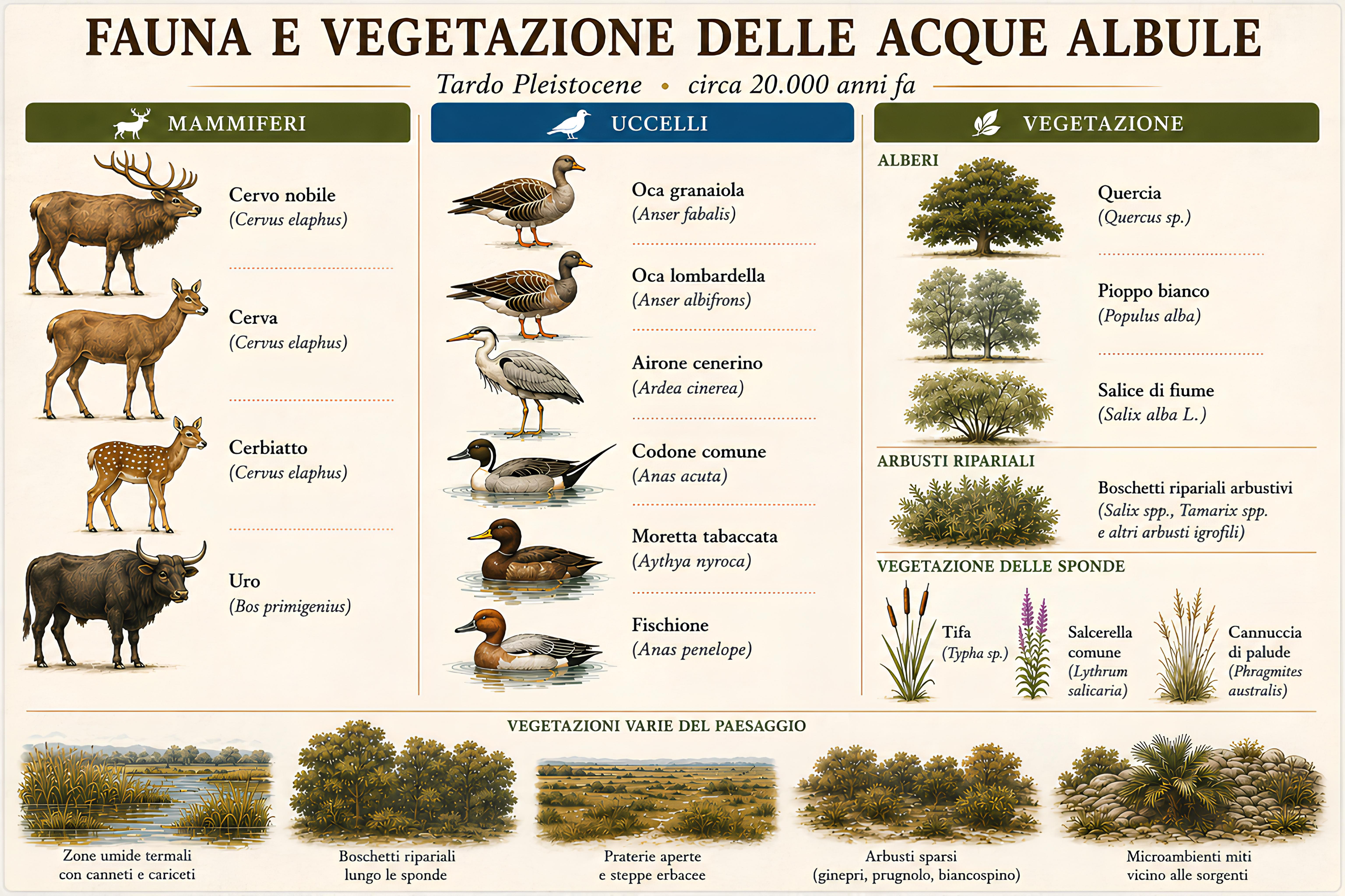
In 2026, an outcrop featuring fossil footprints impressed directly into a layer of travertine was identified on the geological bedrock at the base of the excavated archaeological sequence. Although the slab was preserved over an area of just 10 m², it recorded the passage of numerous prehistoric mammals (Fig. 3). This event occurred within a short timeframe during the last glaciation at the end of the Late Pleistocene, approximately 29,000 to 15,000 years ago. The dimensions and anatomical features indicate the presence of adult red deer or young aurochs (Bos primigenius), alongside medium-to-small cervids or caprids. The animals crossed the area in an east-to-northeast direction, moving along the shores of a shallow lake (Figs. 4-5).
The footprints were impressed into the surface of carbonate mud deposited by thermal waters. Shortly after the herbivores passed, the water level dropped, allowing the temporary emergence of the shoreline sediments, which consolidated and preserved the tracks. Subsequently, the water level rose again, and the layer containing the footprints was sealed by new travertine deposits. In some instances, impressions of the hind paws are superimposed onto the tracks of the fore paws, suggesting that the animals moved at a trotting pace.
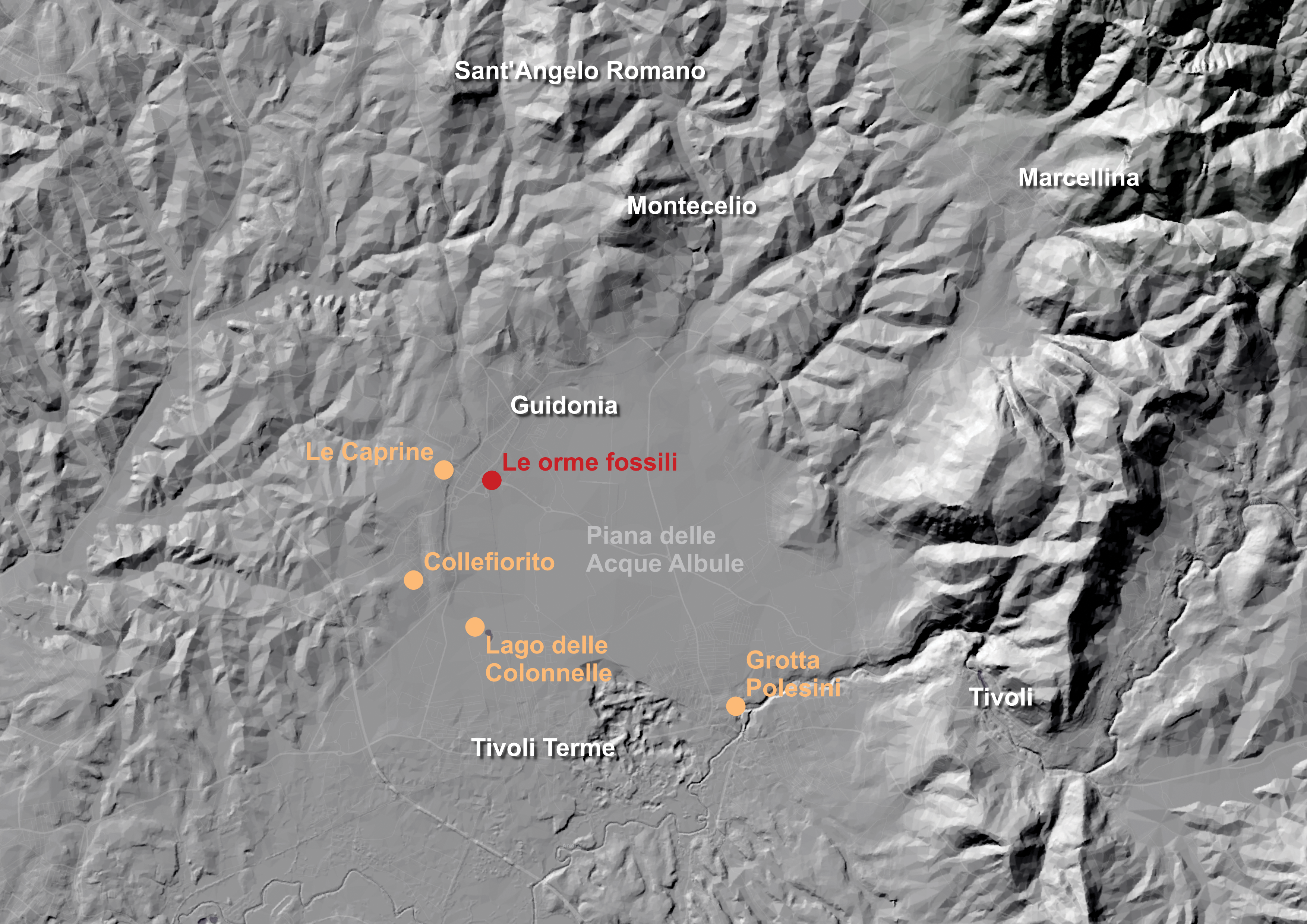
A water-rich ecosystem, favourable ecological niches, and abundant fauna soon attracted the first human communities. The fossil footprints of Guidonia were discovered on the northern fringes of the Acque Albule Plain, an area frequented throughout prehistory by Palaeolithic hunter-gatherer groups, as attested by several major sites discovered nearby (Fig. 6).
The railway works have unearthed the ancient Roman Ager Tiburtinus
Archaeological excavations for the railway project have documented stretches of an ancient road system connected to an infrastructural network serving settlements, estates, and burial grounds. The construction techniques and frequent maintenance works evidence a consistently used thoroughfare; the routing along slight natural ridges, combined with carefully calibrated gradients for water drainage, reveals a design highly attentive to both hydraulic management and the durability of the road. The carriageway, featuring superimposed layers, was typically formed of a compacted surface of small pebbles, limestone shards, and travertine fragments mixed with a dense layer of sand, all resting upon a sub-base prepared with an abundance of miscellaneous ceramic material.
The occupation and agricultural exploitation of the lands are evidenced by the remains of wall structures constructed from travertine rubble, which can be interpreted as the bases for superstructures made of perishable materials, associated with working surfaces such as pits, postholes, and hearths. Noteworthy are two truncated-conical tuff artefacts, featuring a perforated base intentionally blocked, which in all probability relate to specialised production installations. A basin or cistern, hewn directly into the travertine bedrock, was likely connected to the collection and management of water resources.
The cultivation of grapevines is attested by negative features identified in the travertine bedrock, with planting pits that appear to indicate a mixed farming system, probably characterised by the integration of arable crops and living supports for the vines (Vitis arbustiva or married vines technique). Subsequently, closely spaced parallel trenches appear, interpretable as an indication of a more specialised form of viticulture and the gradual abandonment of the married vine practice. In the final phase, trenches and pits coexist once more; the slight shift in the alignment of the rows, arranged along a north–south axis and combined with a wider spacing between rows, suggests a revival of forms of polyculture. The layout, however, appears more regular and standardised, reflecting a technical evolution geared towards increasingly intensive agricultural production.
Life and death. Burials and funeral rites.
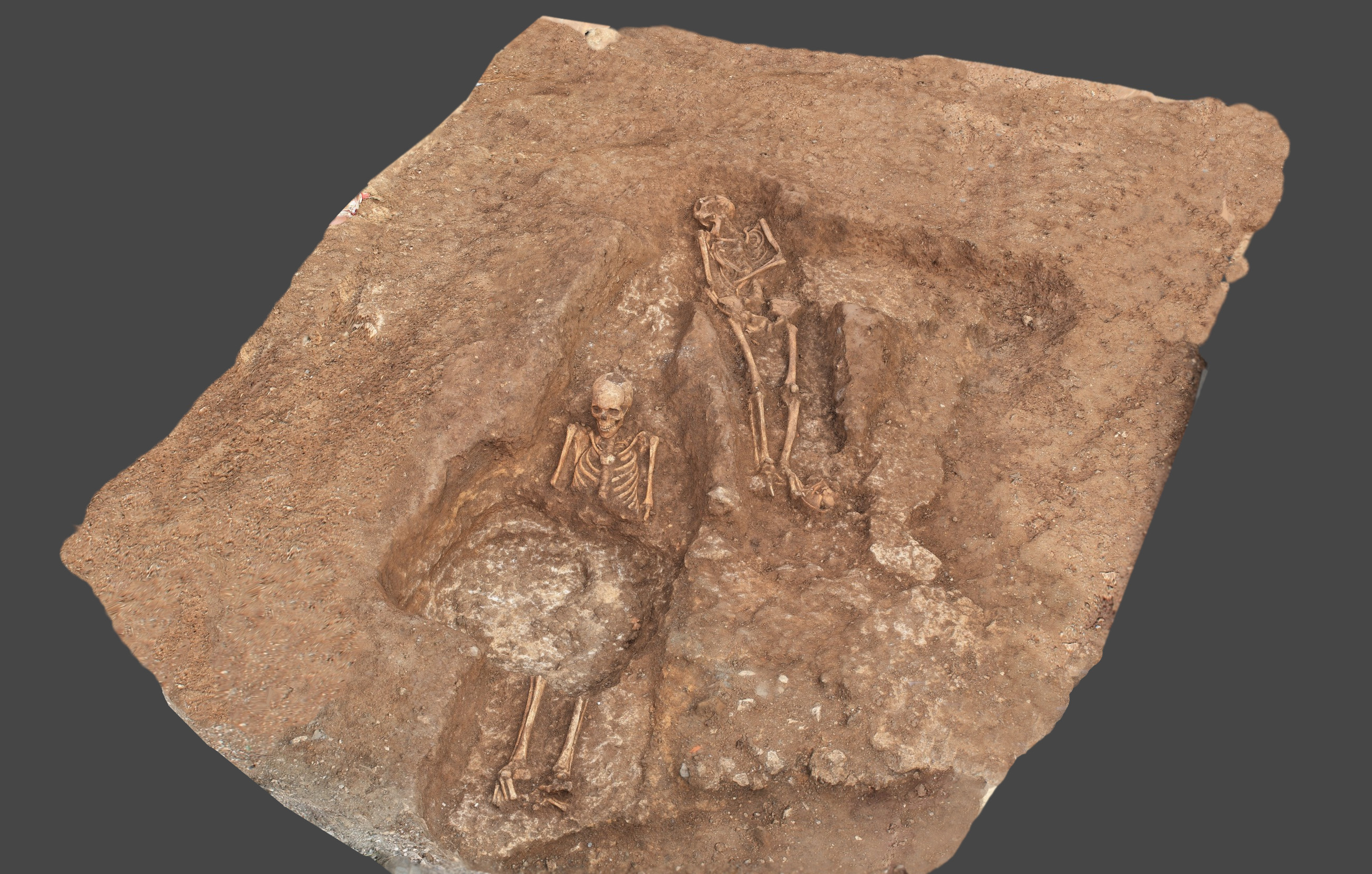
Regarding funeral rites, the burial grounds evidence continual use from the late Republican period to the 2nd century CE, with a period of maximum expansion during the Flavian and Trajanic eras (late 1st to early 2nd century CE). The burials, arranged parallel to the roadways, predominantly consist of inhumations in simple earth graves, occasionally featuring gabled tile-built graves (alla cappuccina) with a pointed roof made of clay tiles or limestone slabs, or bustum-type rituals where the body was cremated directly inside the grave pit (Fig. 7).
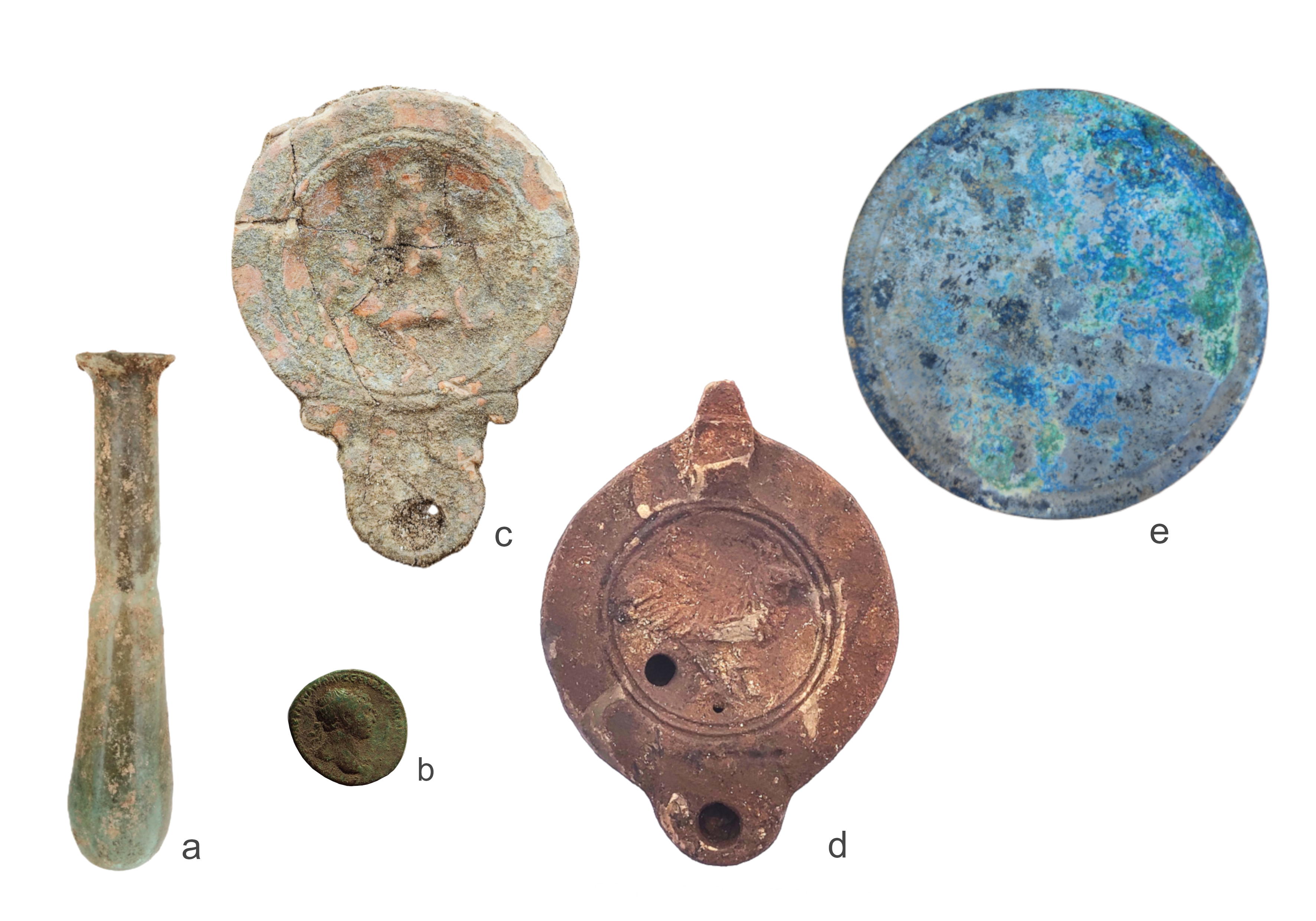
The grave goods, although typical of rural communities of low-to-medium status, fully conform to Roman funerary models. Pottery lamps are the most frequently found artefacts, together with pots known as ollae, plates, and bowls. Some specimens feature scroll-like decorations, erotic scenes, and zoomorphic depictions. The coins found were minted primarily during the reigns of Caligula, Trajan, Domitian, Nerva, and Commodus, and were placed in the grave to allow the deceased to pay Charon to ferry them across the river Styx and into the underworld. Instead, the metal nails were probably meant to ward off evil influences, particularly when associated with coins and lamps.
More uncommon, but highly significant, are the glass ointment jars placed next to the deceased, which were associated with anointing rituals and purification practices. Objects of higher value include a silver disc-shaped mirror, fragmentary bronze pots, and small ornaments made of bone and glass paste (Fig. 8). Finally, of particular interest is the ritual placing of an egg, probably associated with symbolic practices linked to rebirth and fertility, pointing to the profound sense of spirituality that permeated these ancient rural communities.
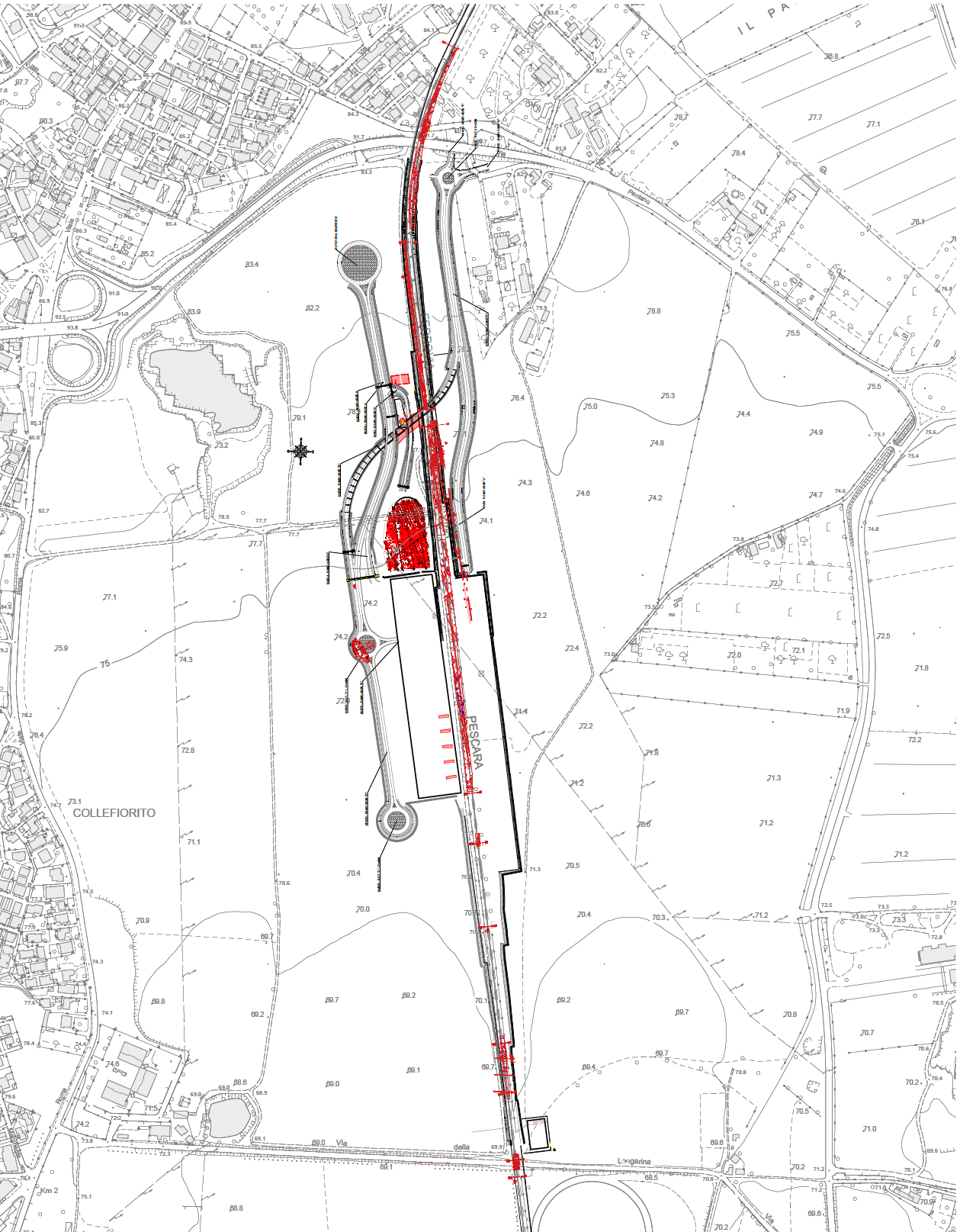
Figure 1 – Ground plan of the new Guidonia Station with the archaeological finds highlighted in red.
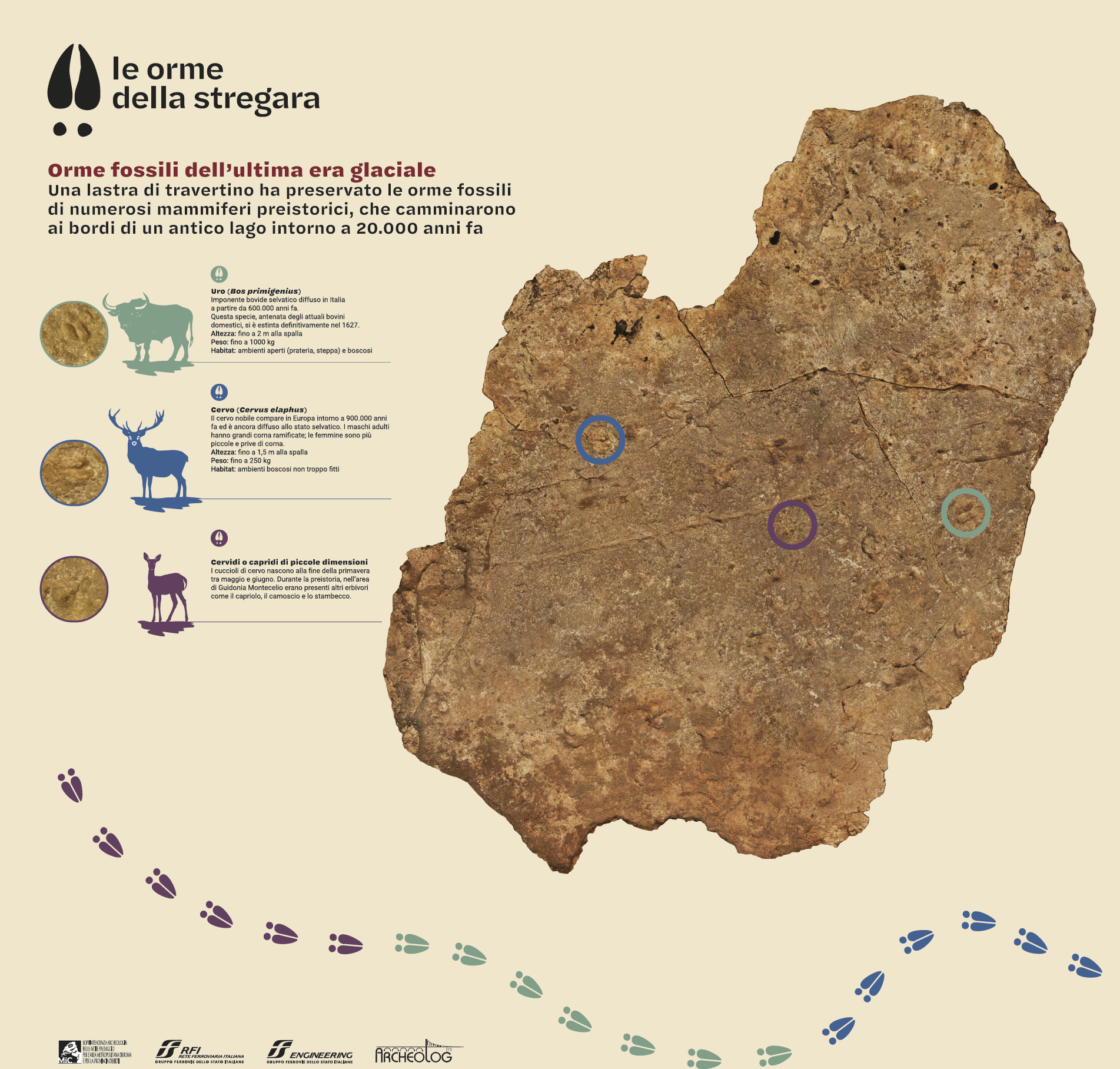
Figure 2 – 3D reconstruction of the area showing the fossil footprints discovered during excavations for track construction at the new Guidonia Montecelio station (D. Pagliarosi).
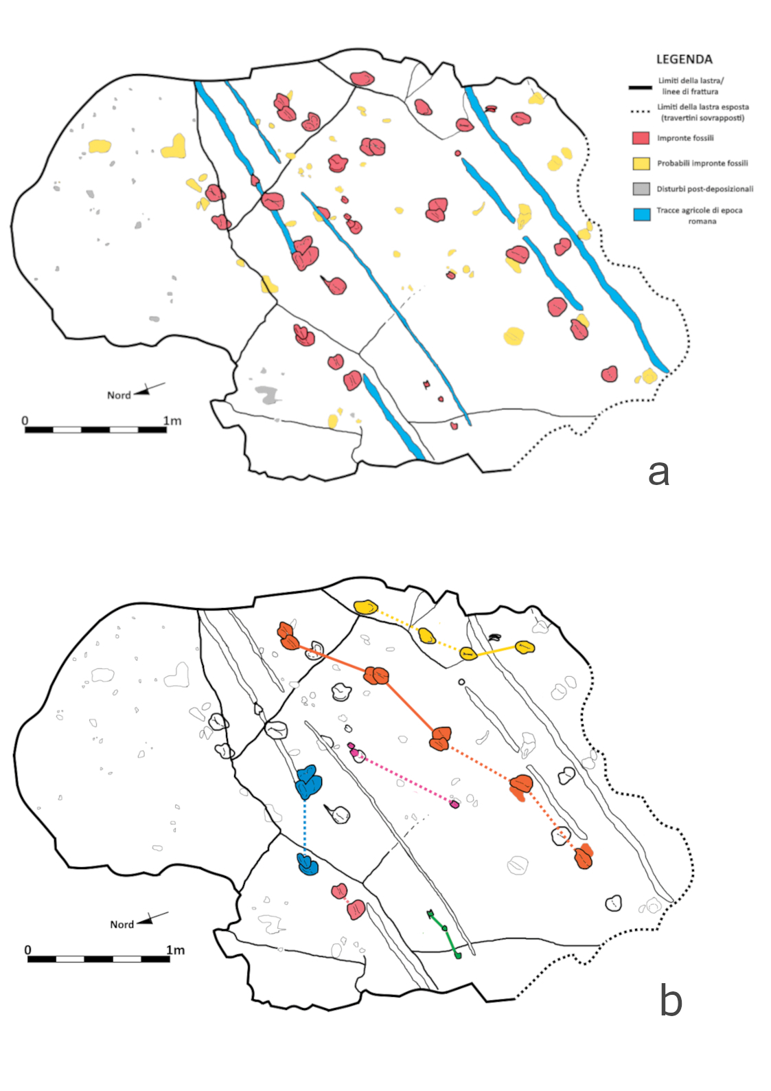
Figure 3 – a) Interpretation of the tracks present on the ancient surface; b) Alignments of footprints left by individual animals—the colours represent different tracks (F. Altamura).
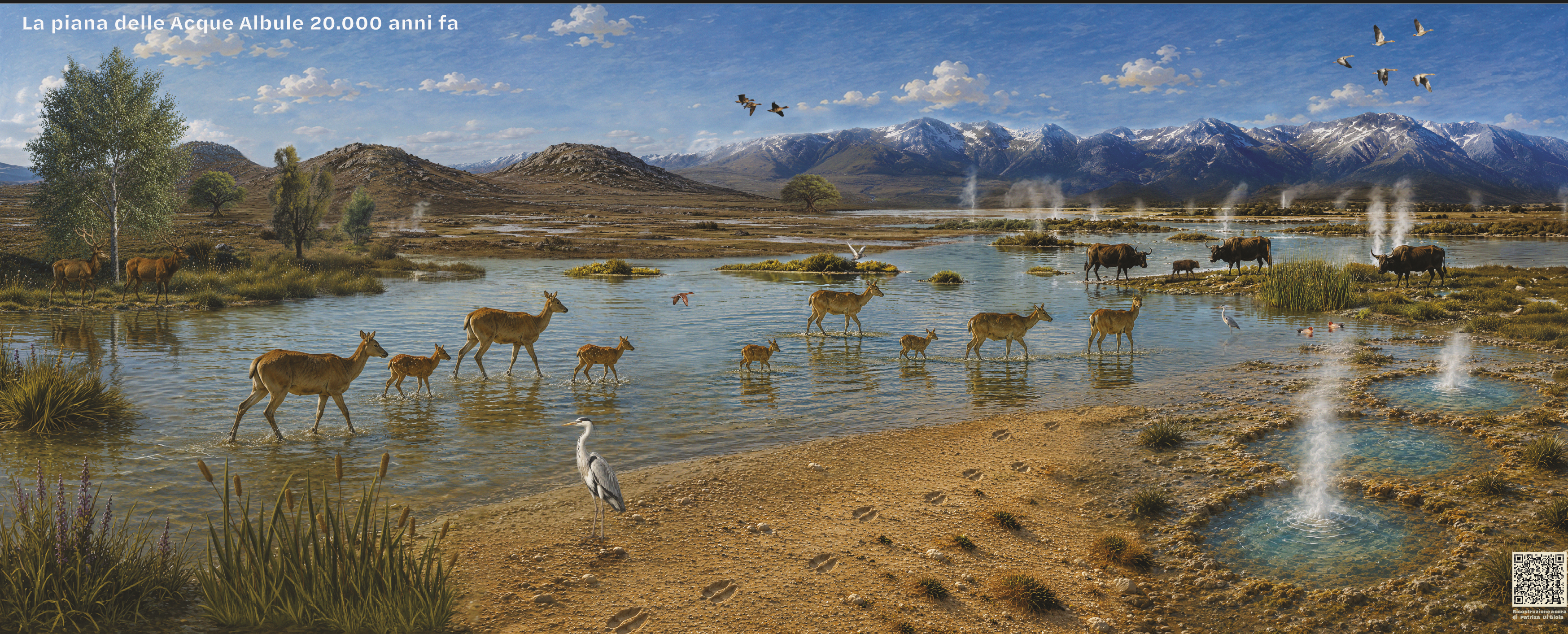
Figure 4 – Paleoenvironmental reconstruction of the Acque Albule plain 20,000 years ago (P. Gioia).