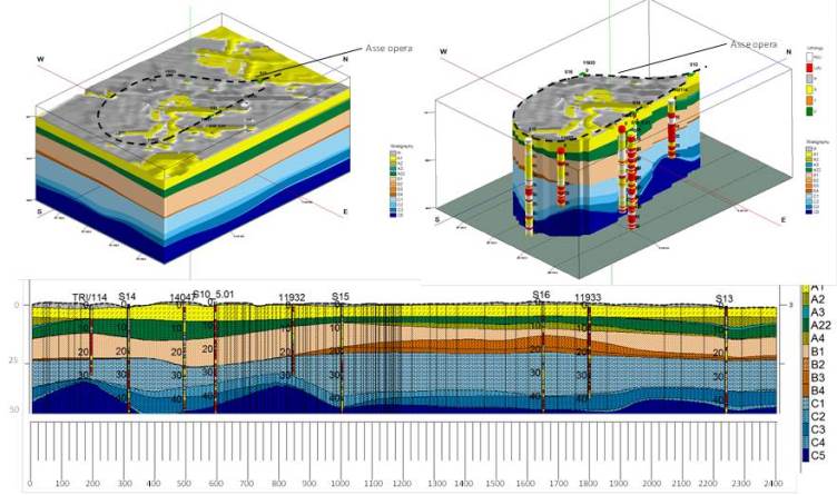
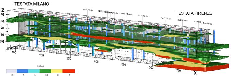
GEOLOGICAL DESIGN—DRIVEN BY SITE-SPECIFIC GEOLOGICAL SURVEYS AND GEOGNOSTIC INVESTIGATIONS—RECONSTRUCTS THE GEOLOGICAL, STRATIGRAPHIC, STRUCTURAL, AND HYDROGEOLOGICAL CHARACTERISTICS OF THE PROJECT SITE. THESE DATASETS ARE COMPILED INTO A DIGITAL 3D SUBSURFACE GEOLOGICAL MODEL DEVELOPED VIA LEAPFROG WORKS SOFTWARE.
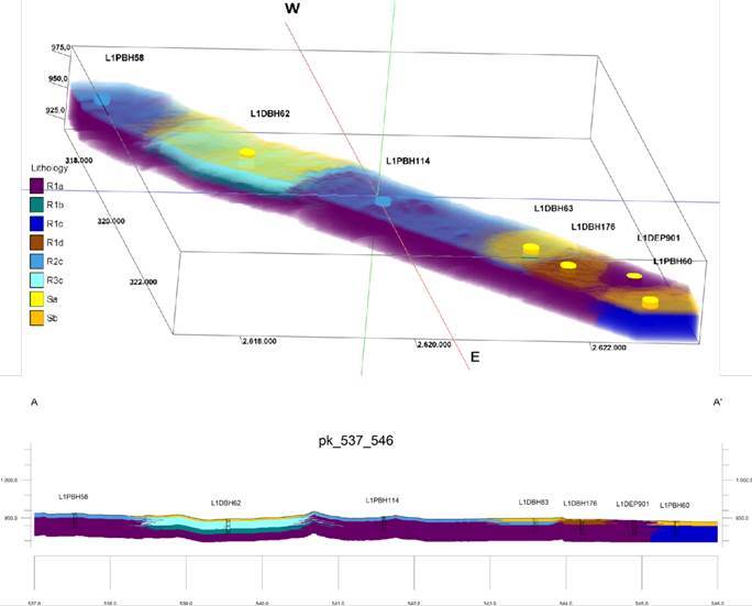
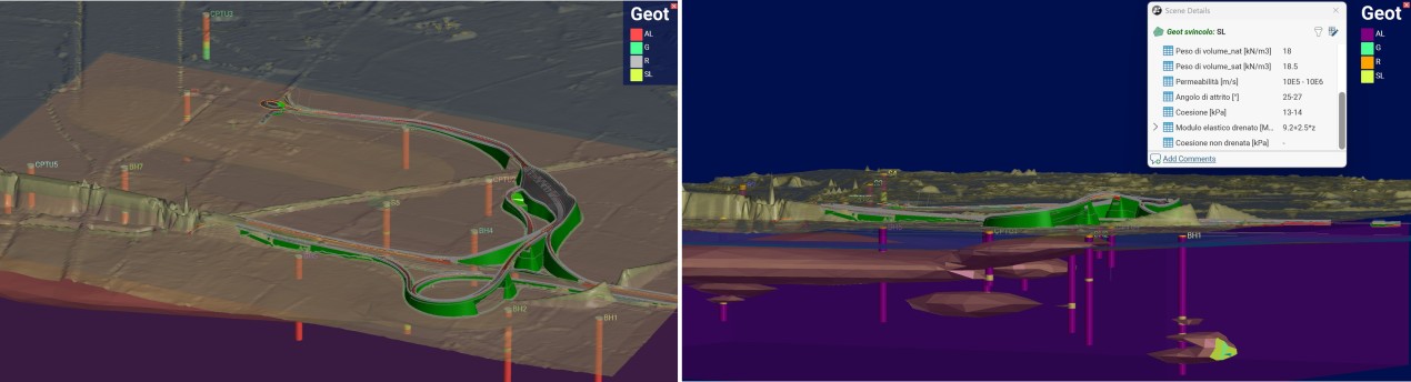
Geological modelling integrates with geotechnical analytical studies by assigning geomechanical parameters to identified lithotypes, thereby defining the digital 3D geotechnical model. These models, complete with all associated IT parameters, are used to design the project infrastructure through integration into the federated, multidisciplinary model. Furthermore, geological and geotechnical profiles and geotechnical cross-sections can be extracted from the 3D models for verification in specialist software environments (Plaxis, Geoslope).
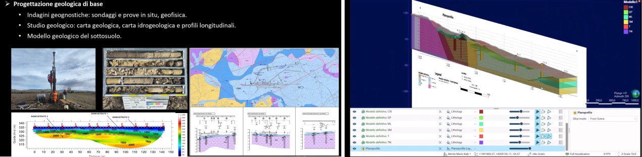
Basic geological design
- Geotechnical investigations: boreholes, in-situ tests and geophysics
- Geological study: geological map, hydrogeological map, and longitudinal profiles.
- Subsurface geological model
GEOTECHNICAL MODELLING IS DEVELOPED AS PART OF INNOVATIVE DESIGN PROCESSES AIMED AT ACHIEVING A DIGITAL TWIN OF THE RAILWAY INFRASTRUCTURE—CAPABLE OF INTEGRATING ALL THE RELEVANT INFORMATION INTO A SINGLE ENVIRONMENT AND BUILDING ON THE BASIC DESIGN DATA
Geotechnical data management utilising 3D geometric modelling proves highly effective for complex civil engineering works and intricate stratigraphic environments. It is equally critical in scenarios where traditional two-dimensional representations of extensive spatial data would introduce unacceptable levels of approximation.
This 3D approach enables immediate analysis and visualization of subsoil stratigraphy and geomechanical properties, leveraging large-scale data processing to deliver high-fidelity graphical outputs, such as profiles and cross-sections, that directly support design workflows.
Furthermore, integrating the geotechnical data model with the various infrastructure information models enables real-time data updates across all design phases. This methodology delivers significant added value to the project's informatisation and digitalisation process, enhancing overall data consistency, traceability, and collaborative sharing.